featured Slider

Big Hill Springs - Hike

A hike so close to the city, it's a hidden gem. Within a small provincial park, it's a hike you can do on a summer evening, pack a picnic and enjoy some nature!

Difficulty: easy
Round trip: 2.3 km
Hiking Time: 20 min - 45 min
Elevation Gain: 20 m
FitBit: approx. 3,000 steps and 17 flights of stairs
Location: Big Hill Springs Provincial Park


TRAIL HEAD
Marked: No
Facilities: Yes
How to get there: From Calgary drive north west on Hwy 1A through Bearspaw. At Hwy 766 (across from Rock Pointe Church) turn right (north).Then at Hwy 567 drive west a short ways to Range Road 34A where you'll turn south. Drive to the parking lot at the end of the road.

Map to Big Hill Springs, click for directions

HIKE DETAILS
The trailhead is not marked, but is very easy to find. Once you have parked in the small lot (which is a dead end from the road leading into the park) head to the trail which is west, across from the outhouses. Immediately there are four picnic tables and a small stream.

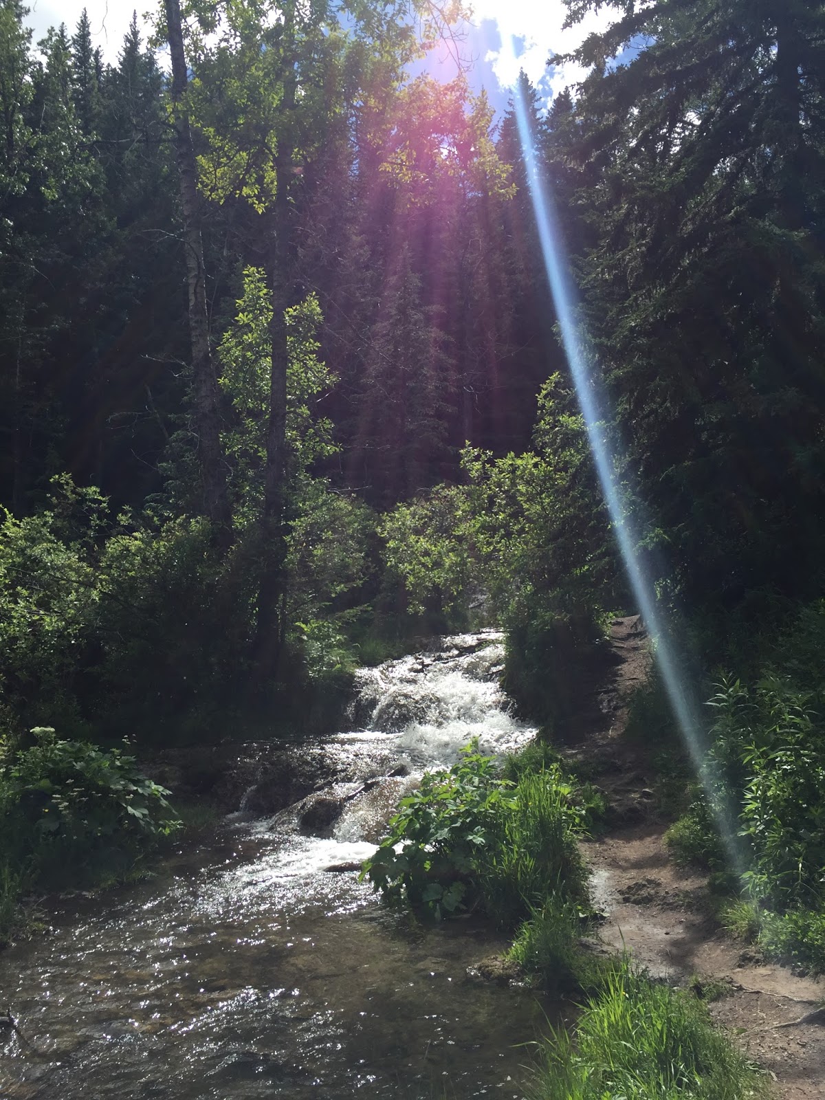
Follow the most boot beaten path around, stopping to admire the natural waterfalls and surrounding nature. There aren't any mountain views, but that doesn't mean it's not beautiful! Smaller paths shoot off from the main one, but all in all the loop shouldn't take more than an hour if you are taking it quite slow, 20 min if you cruise and don't stop. ]

At the end of your hike, if it's not too busy and there is a table available, enjoy a picnic lunch in the cool shade near the pond. :)

Kid Friendly: yes
Dog Friendly: yes

Happy Hiking!


Five Hikes to Do This Summer


Unsure which hike to try this weekend? Why not give one of these a go. These are some of my favorite hikes, in all levels of effort. Click on one for more details and maybe you'll find one just for you!


1) Grotto Canyon (easy) 
A popular hike, but for good reason. 
Instead of hiking up, you are hiking through the canyon with a variety of sites to see!


2) Fullerton Loop (light)
Some of the best hikes are loops so that you don't ever see the same thing twice!


3) West Wind Pass (light - moderate)
Nothing but views, views, views on this one!


4) Picklejar Lakes (moderate - strenuous) 
Is your favorite snack pickles? Then this one is for you! Joking, but it's still great!


5) Barrier Lake Lookout (strenuous) 
Likely a busy place, but not far from the city. 
There's a lake, there's mountains, it's all worth the climb!

Lake Agnes Tea House - Hike

A popular hike, that with some work leads to a great reward, a beautiful view of Lake Agnes as well as a pit stop at the tea house which is only accessible by hiking to it. 

Difficulty: moderate
Round trip: 7 km
Hiking Time: 2.5 - 3.5 hours 
Elevation Gain: 380 m
FitBit: approx. 11,700 steps and 124 flights of stairs
Location: Lake Louise


TRAIL HEAD
Marked: Yes
Facilities: Yes
How to get there: From Calgary drive west on Hwy 1 towards Lake Louise. Drive 162km and at Hwy 1A take the exit to go west. The road turns into Lake Louse Dr., continue on it until you reach the Lake Louise parking lot. If it is full, there is a shuttle parking lot down the highway.

Click for directions on Google Maps
Trail Map


HIKE DETAILS
Your trailhead begins at the north end of Lake Louise (as seen in the map above). It is marked by a sign near some garbage bins, but the sign is small. To keep it simple, walk along the path by the lake in front of the chateau, and when the trail splits, keep right. From there just follow the wide trail.

It will be busy on the trail as this is a popular spot (you'll get that indication by the parking lot), but it is beautiful nonetheless. Along the way there is a small lookout over Lake Louise. Another viewpoint spot is at Mirror Lake and that is very nice, but just short ways up now is the final detestation of the tea house and Lake Agnes. Enjoy the views and a cup of tea (cash only) if you so desire!


Kid Friendly: yes
Dog Friendly: yes


NOTE
-The majority of the hike is in the trees, but it still is warm on a hot sunny day. It then can be cooler and windy at the top, so bring layers. 
-There was still snow in early June, so be prepared for that if you go in the earlier or later months.
-For the tea house website click here.

Happy Hiking!


Many Springs Trail - Hike

A quick and very beautiful interpretive trail. Enjoy an easy walking path and scenic views of the surrounding mountains.

Difficulty: Easy
Round trip: 2.5 km
Hiking Time: 30 min - 1.5 hrs
Elevation Gain: 21 m
FitBit: approx. 4,000 steps and 7 flights of stairs
Location: Bow Valley Provincial Park


TRAIL HEAD
Marked: Yes
Facilities: Yes
How to get there: From Calgary drive west on Hwy 1 towards Canmore. Take exit 114 onto Hwy 1X and take the first left into the Bow Valley Campground. You can stop at the Park Ranger Station for an area map if you wish, otherwise continue driving towards the Whitefish Day Use Area. You will see your trail on the left just prior to the parking lot of the picnic area.
Click for directions from Calgary
Click for larger map.

HIKE DETAILS
Your trailhead is marked by the trail sign. Begin your hike soon arriving at a hiker sign pointing you to the right. Enjoy the views around you of the pond and the mountains so near! If you desire take your time to read the interpretive signs along the way.

It's a short trail, but perhaps not one to rush through else it be a waste of time. Enjoy your walk and what it has to offer. Sometimes it's as simple as that :)

Kid Friendly: yes
Dog Friendly: yes

Happy Hiking!


Windy Peak Hills - Hike

A great shoulder season trek with plenty of scenic variety on the peaks and views of the prairies (Calgary on a clear day) and the mountains.

Difficulty: Strenuous
Round trip: 11.5 km
Hiking Time: 5-6 hrs
Elevation Gain: 744 m
FitBit: approx 17,000 steps total and 244 flights of stairs
Location: Kananaskis

TRAIL HEAD
Marked: No.
Facilities: No.
How to get there: From Calgary drive south on Hwy 2. You have multiple options to go through different small towns such as Black Diamond, Longview, or High River, just choose the way you feel best, and make your way south on Hwy 22 to Hwy 532. Turn right (W) and drive approx 21.5 km to where you'll see a small pond. Cross the Texas gate and park in the pullout just after it on your left.

HIKE DETAILS
Find your trail on the north side of the Texas gate on the same side of the road that you parked, climbing up the hill to the east. Your path is pretty well trodden the majority of the way and you'll hike up and down five hilly peaks. If the trail ever fades, keep trekking in the direction of the farthest peak and you'll surely find it again. When you see another trail intersects yours, going north and south (as in the photo below) do not follow this one, but continue upwards and east.

The details for this hike end right before Windy Peak, but with it in sight, just covered in snow. Surmount the last rocky hill and enjoy a well earned rest before heading back the way you came.
Looking at Windy Peak (you can see the trail continue, but this is where we stopped).

Enjoy the variety of scenery all around you on this hike and even on each individual hill. Plus if you look far to the North on a clear day you may see Calgary.


NOTE
-There is no shelter from the sun or wind so be prepared with sunscreen and layers if called for. 
-Poles would be handy on this one.  
-The details here are technically to the hill just before Windy Peak. As there was too much snow on Windy Peak we didn't make it that far nor to the decent which would make the trail a loop versus there and back again. That will make a difference for elevation gain and distance/hiking time. For details to the loop click here.

Kid Friendly: yes *at your discretion of how far they can go. But sometimes kids have more stamina than us adults :) 
Dog Friendly: yes

Happy Hiking!


Bow River Loop and Larch Island - Hike


A hike right in town with mountainous views you don't have to drive far for. Stop at a bench along the path if you choose, but overall just enjoy being right in nature on this easy trail where you decide how far to hike.

Difficulty: Easy
Round trip: 5.5 km (variable)
Hiking Time: 1 - 2 hours (variable) 
Elevation Gain: negligible 
FitBit: approx 8,000 steps and 2 flights of stairs
Location: Canmore


TRAIL HEAD
Marked: Not marked, but there are maps along the path.
Facilities: There are public washrooms on main street.
How to get there: From Calgary drive west on HWY 1 to Canmore. Drive to Bridge Road and you'll see the boat launch parking lot on the West side of the bridge and South side of the road. Or you might find parking on the side of the road.

Click for directions in Google Maps.
Directional arrows just for reference, not mandatory at all!

HIKE DETAILS
This hike has no distinct start or finish, however starting along Bridge Road is likely the easiest for parking. Simply follow the path to your hearts content. The path and hiking time/distance outlined above is just the example of the route we took. There are maps at major junctions to help you along the way. You may even be so inclined to hop over to main street for a bite to eat, then get back to your trek.

The path is gravel and caters to many and in the early season of hiking if you don't want to battle the snow left in the mountains or have little tykes or pets this is a great option. You get a beautiful mountainous view and the feel of being in the great outdoors without even having to leave town!


Kid Friendly: yes
Dog Friendly: yes

Happy Hiking!