

A beautiful and manageable hike with a variety of lovely views along the way, forest, mountains, lakes, although no pickles here :)
Difficulty: strenuous
Round trip: approx 12 km
Hiking Time: 3.5 - 4.5 hrs
Elevation Gain: 557 m to 4th lake, 655 m cumulative*
FitBit: approx 18,000 steps and 183 flights of stairs to the lakes, 215 flights cumulative.
Location: Kananaskis
TRAIL HEAD
Marked: No
Facilities: Yes
How to get there: You can access the trail two ways out of Calgary, but note that hwy 40 from Kananaskis Lakes Trail to Highwood junction is closed from Dec 1 to June 15 so the trail will not be accessible from either approach during that time.
Option A: If you come from hwy 1, travel approx 87.5 km from where you turnoff the Trans Canada. Turn left (w) into the Lantern Creek day-use area (not the picklejar picnic area).
Option B: Coming from the SE of Calgary drive to Longview and from hwy 22, follow the signs to Kananaskis Country turning right onto hwy 541 West. Drive approx 60.4 km. (Hwy 541 will turn into hwy 40 where it intersects with hwy 940, this is Highwood Junction). Turn left (w) into the Lantern Creek day-use area.

Click map for directions from Calgary

HIKE DETAILS
Find the trail head by exiting the parking lot, crossing to the east side of the highway and going left (N). The start of the trail is easy to spot ascending into the forest on the east (right) side of the highway. You'll find it is very self explanatory from there, the majority of your hike being single file through the trees, across some grassy slopes, with views all around (which might make you wanna sing "the hills are alive with the sound of music"! The grade changes periodically and some sections are steeper than others, but it is do able by going at your own pace. There is a nice balance of ascending and flatter areas.
Depending on your pace, approximately 1 hour into your hike you'll reach the steepest section of the trail. Within the last couple of years it would seem some residue has been placed on top of the dirt that gives you an assistance in traction for both the ascent and decent. Poles may also help here as there are no switchbacks and it is just straight up. Once you've concurred that section you'll reach a slight plateau where a path leads straight and down into the forest, but rather, you must turn right to the east and continue upwards. Breathtaking views await!
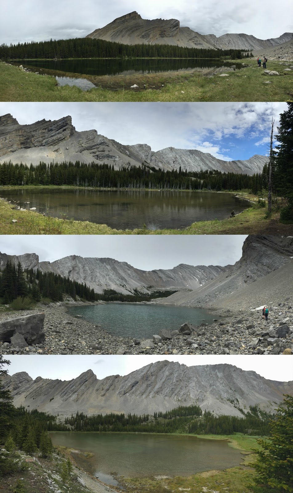
You'll then begin descending to the first lake. Your path turns into shale and is narrow at points so caution is recommended. Also traverse some rocky sections, there is one minor drop down you sort of have to 'clamber' over and we had to lift my dog down. But soon after reach your first of four destinations. Don't stop at the first though. The lakes are each only minutes apart (approx 20 min between the 1st and 4th) so continue along the path to enjoy the remaining 3 lakes.


EXTRA TIPS
-In mid June the first lake had a ton of little flies so don't stop there for lunch, the 4th lake was preferable with lots of places to sit and far enough from the water the bugs aren't a bother.
-Along the path of the 2nd lake on the way to the 3rd there appears to be a fork, both paths get you to the 3rd lake.
-When in view of the 3rd lake you'll be hiking across a bed of rocks and you can go either way around the lake. However, if you steer to the left side rather, the trail will be much easier on a dirt path instead.
Option A: If you come from hwy 1, travel approx 87.5 km from where you turnoff the Trans Canada. Turn left (w) into the Lantern Creek day-use area (not the picklejar picnic area).
Option B: Coming from the SE of Calgary drive to Longview and from hwy 22, follow the signs to Kananaskis Country turning right onto hwy 541 West. Drive approx 60.4 km. (Hwy 541 will turn into hwy 40 where it intersects with hwy 940, this is Highwood Junction). Turn left (w) into the Lantern Creek day-use area.
|
| Click map for directions from Calgary |

Depending on your pace, approximately 1 hour into your hike you'll reach the steepest section of the trail. Within the last couple of years it would seem some residue has been placed on top of the dirt that gives you an assistance in traction for both the ascent and decent. Poles may also help here as there are no switchbacks and it is just straight up. Once you've concurred that section you'll reach a slight plateau where a path leads straight and down into the forest, but rather, you must turn right to the east and continue upwards. Breathtaking views await!
You'll then begin descending to the first lake. Your path turns into shale and is narrow at points so caution is recommended. Also traverse some rocky sections, there is one minor drop down you sort of have to 'clamber' over and we had to lift my dog down. But soon after reach your first of four destinations. Don't stop at the first though. The lakes are each only minutes apart (approx 20 min between the 1st and 4th) so continue along the path to enjoy the remaining 3 lakes.
EXTRA TIPS
-Along the path of the 2nd lake on the way to the 3rd there appears to be a fork, both paths get you to the 3rd lake.
-When in view of the 3rd lake you'll be hiking across a bed of rocks and you can go either way around the lake. However, if you steer to the left side rather, the trail will be much easier on a dirt path instead.
Happy Hiking!

*Other resources say that the elevation gain is only about 450m, however according to the number of flights of stairs my fitbit calculated I believe this is a more accurate representation of the elevation climbed vs. just the height difference from the trailhead to the destination. Not having used a gps I can't say for certain, but I will say the effort required on this one is very similar to Barrier Lake Lookout.
*Other resources say that the elevation gain is only about 450m, however according to the number of flights of stairs my fitbit calculated I believe this is a more accurate representation of the elevation climbed vs. just the height difference from the trailhead to the destination. Not having used a gps I can't say for certain, but I will say the effort required on this one is very similar to Barrier Lake Lookout.


